Postcards from Google Earth
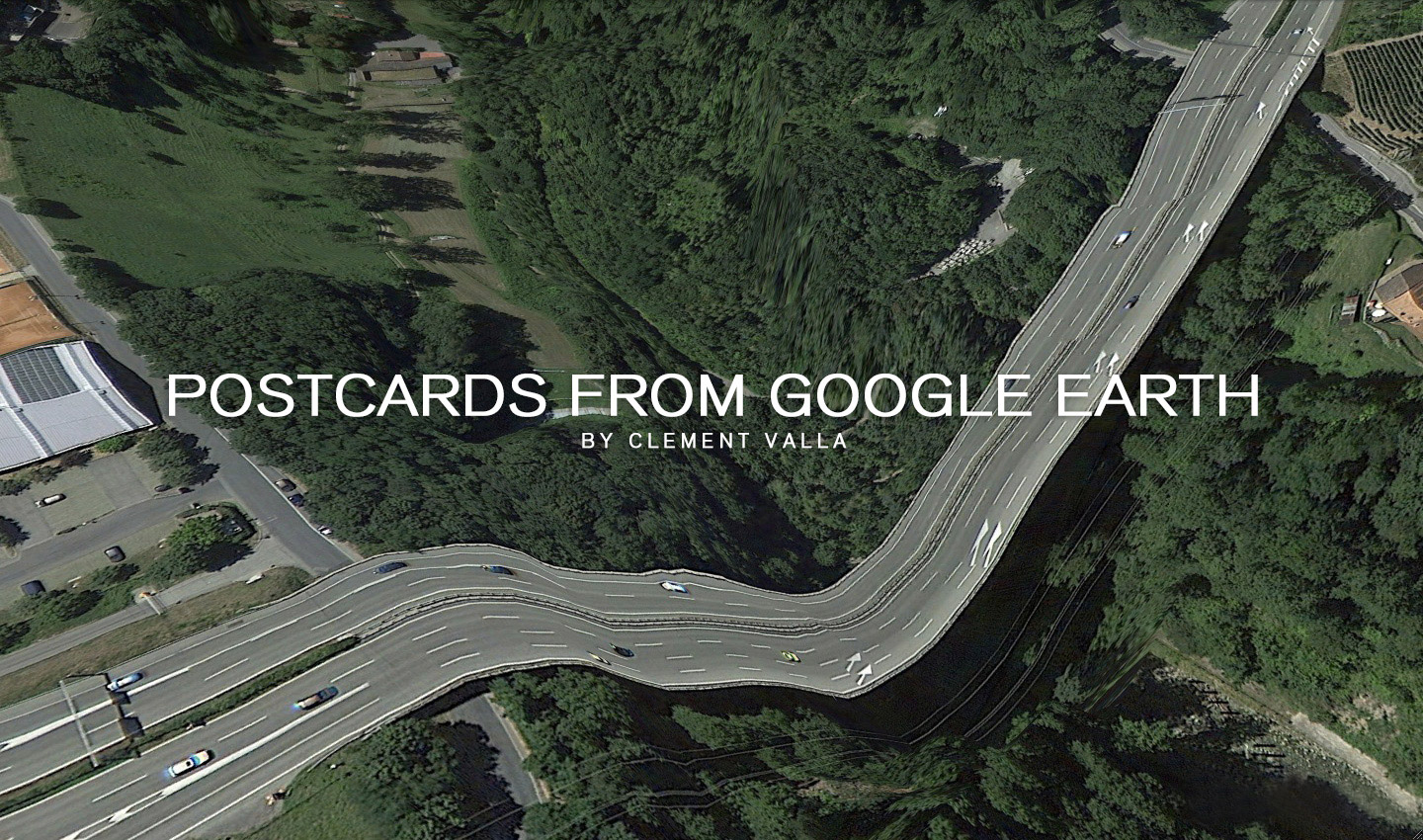
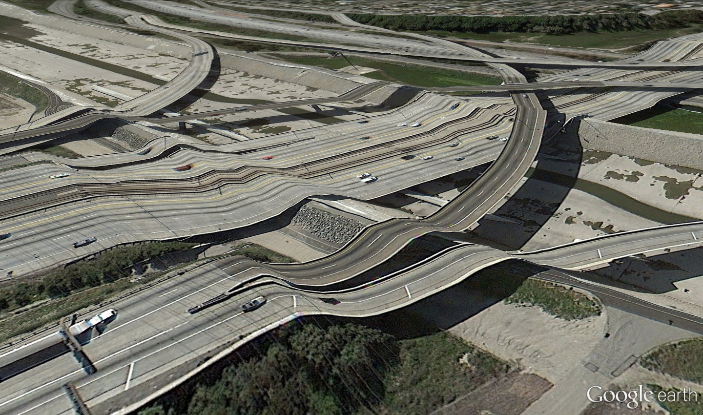
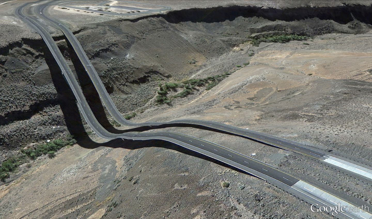
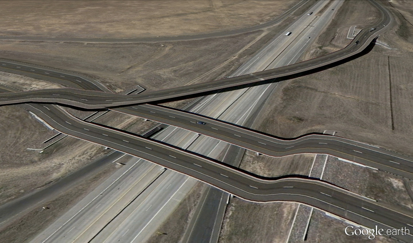
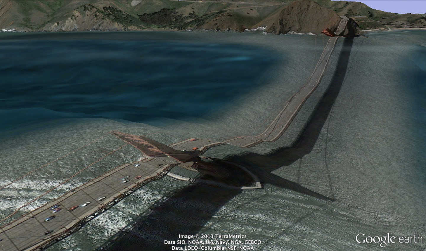
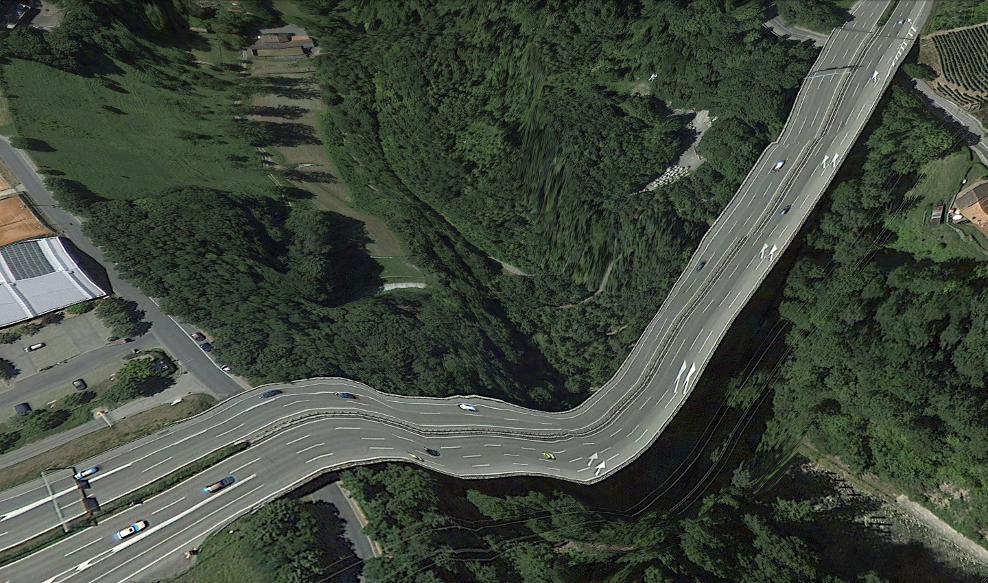
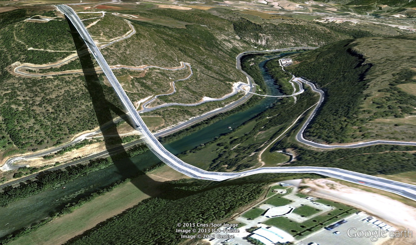
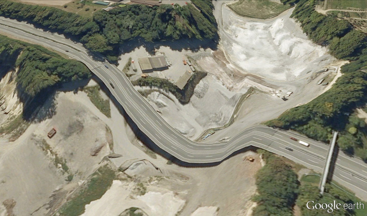
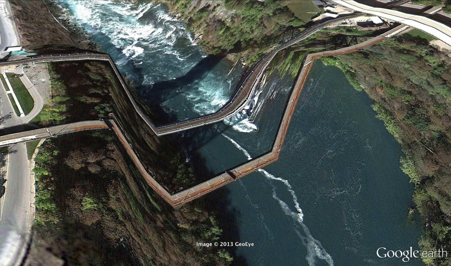
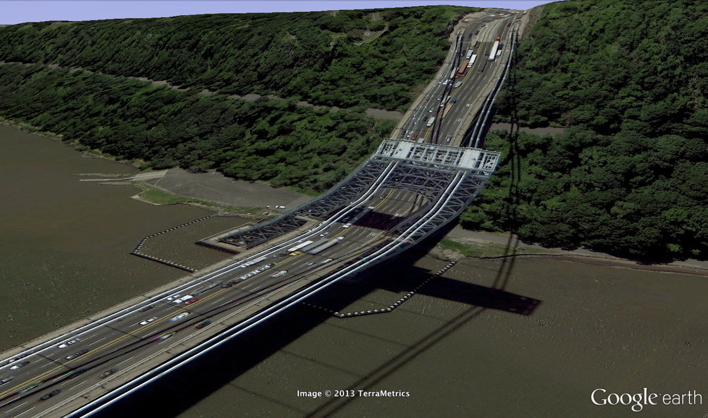
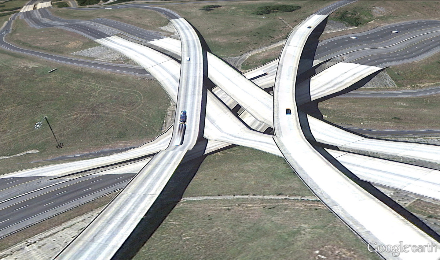
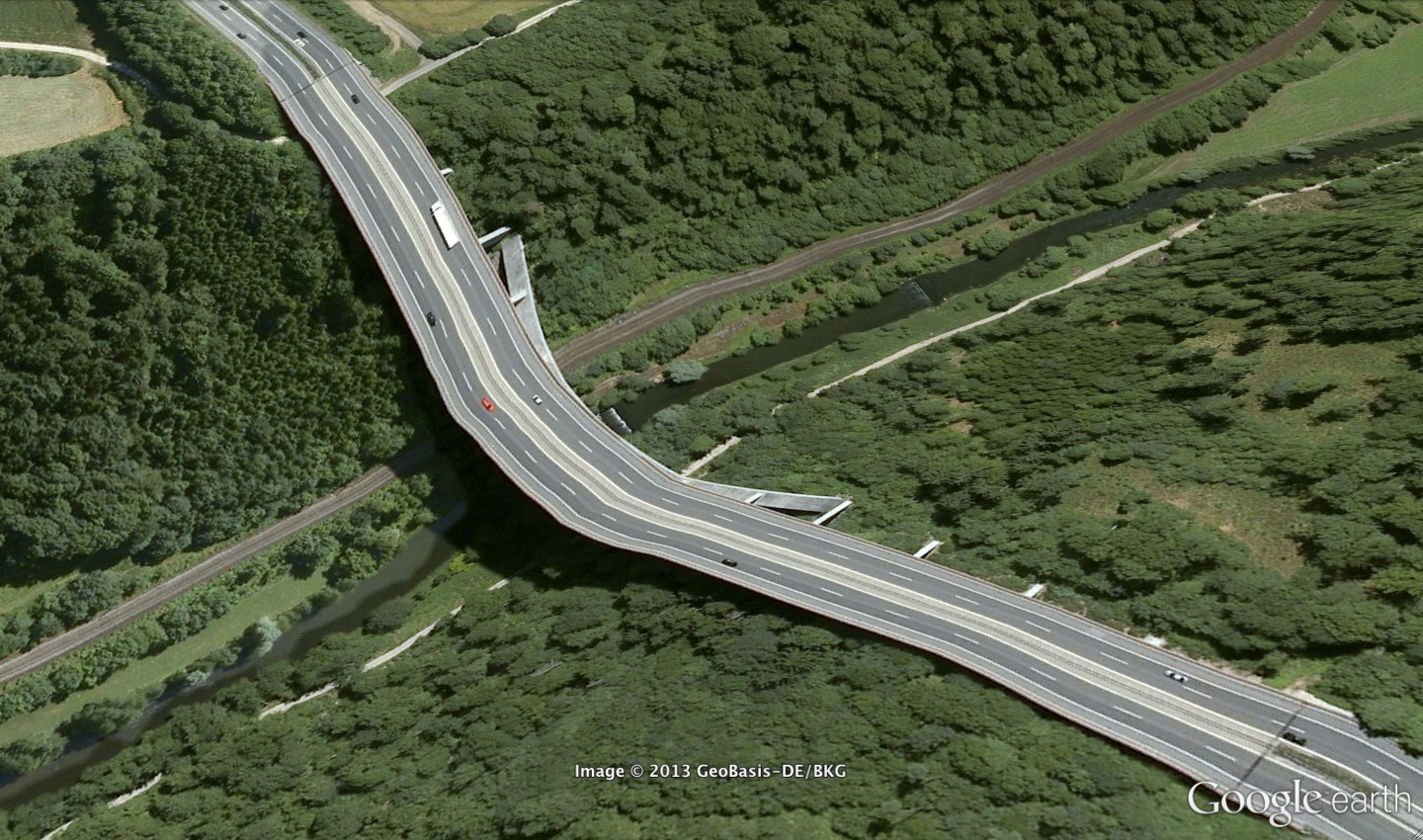
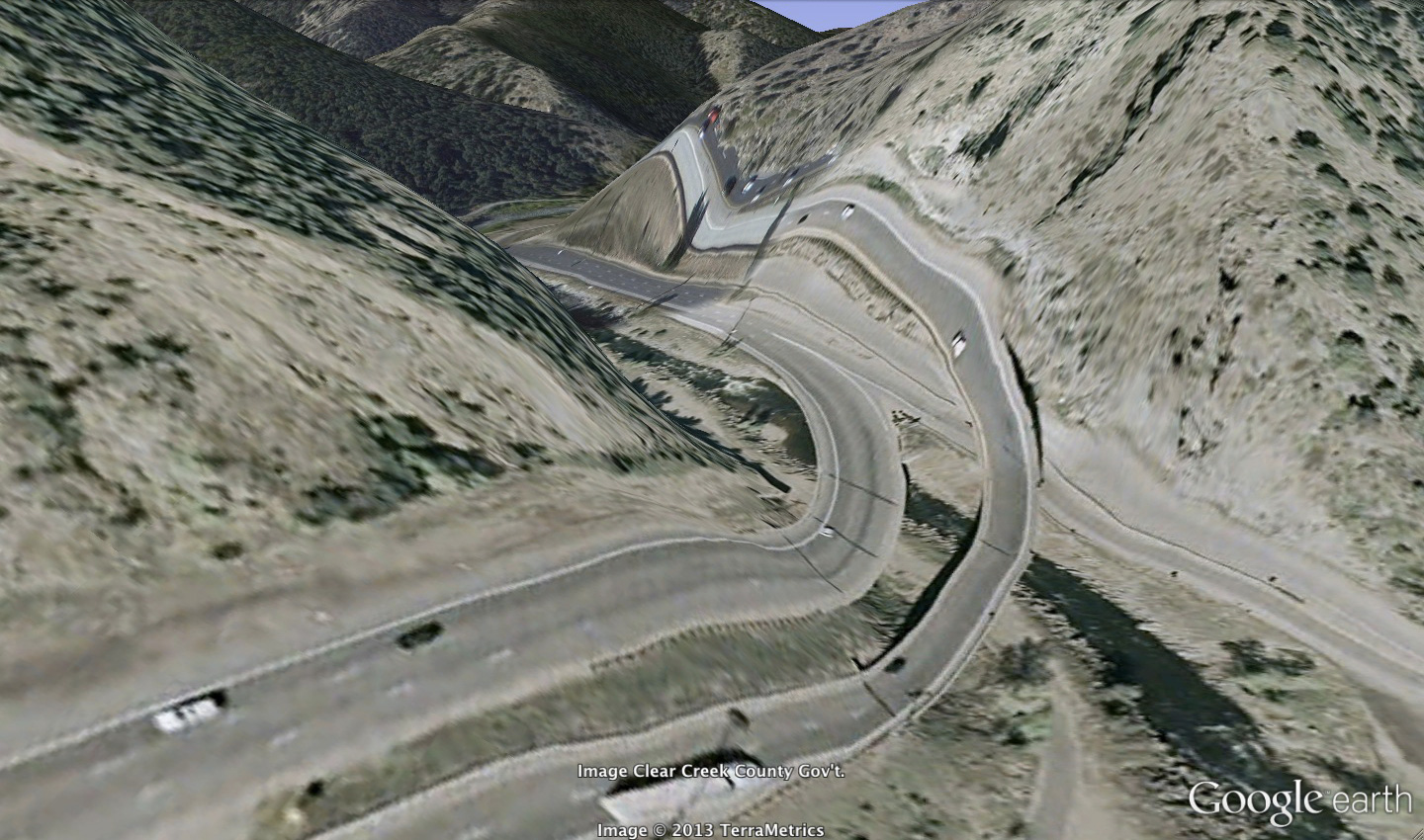
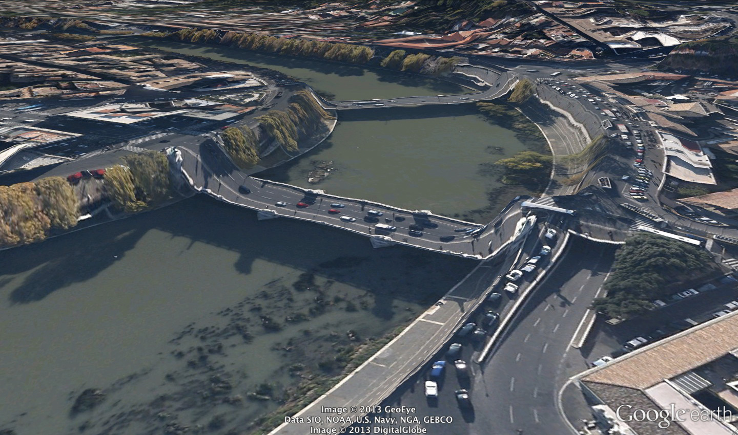
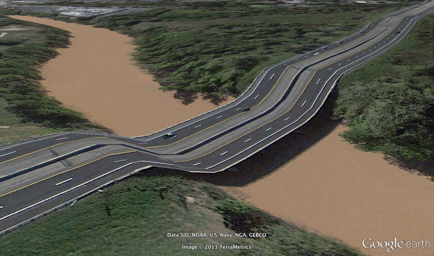
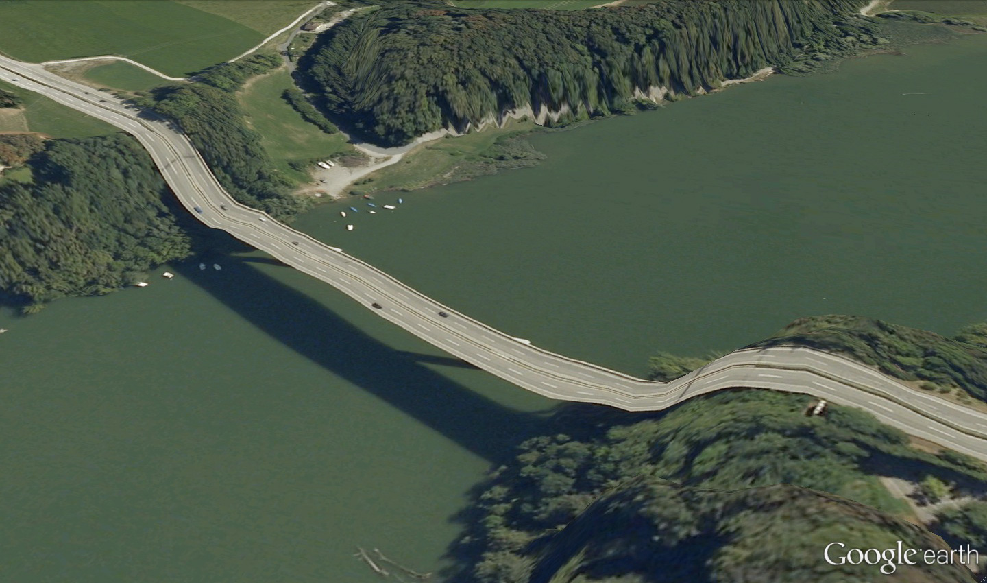
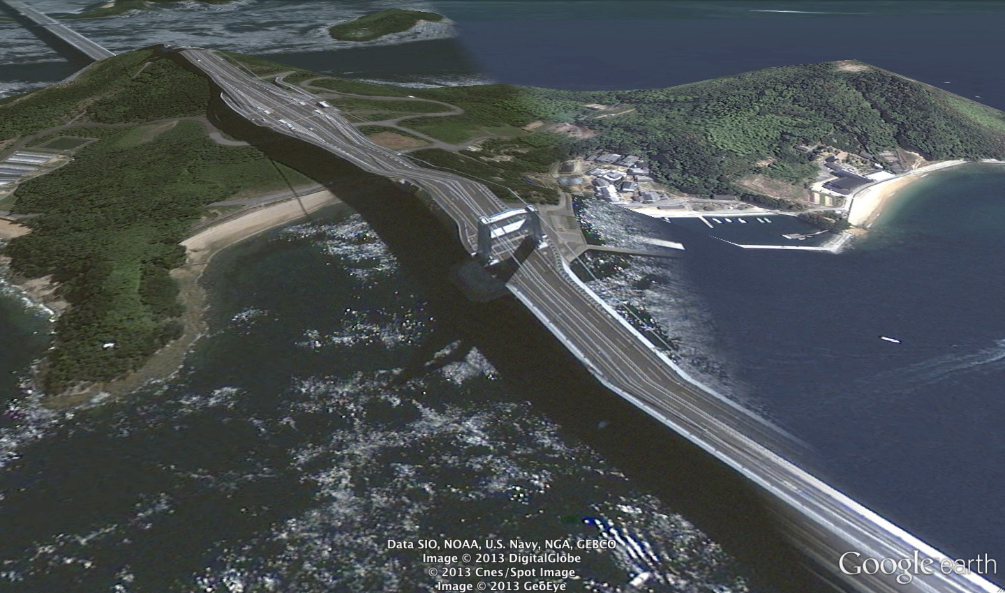
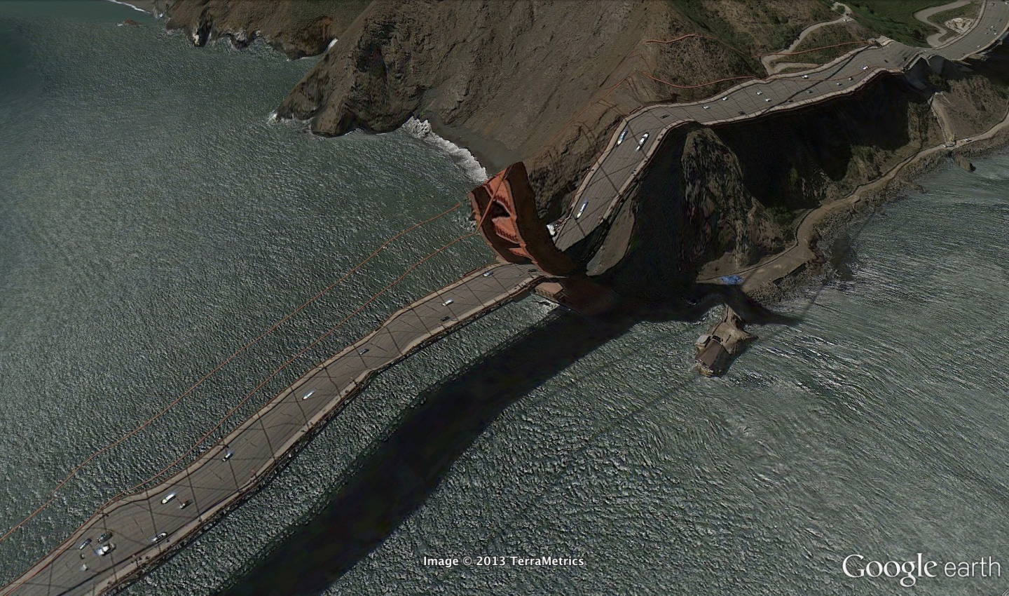
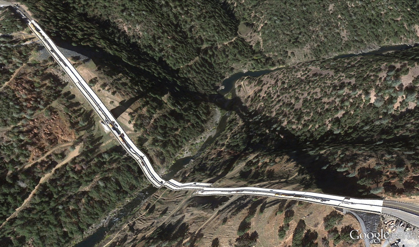
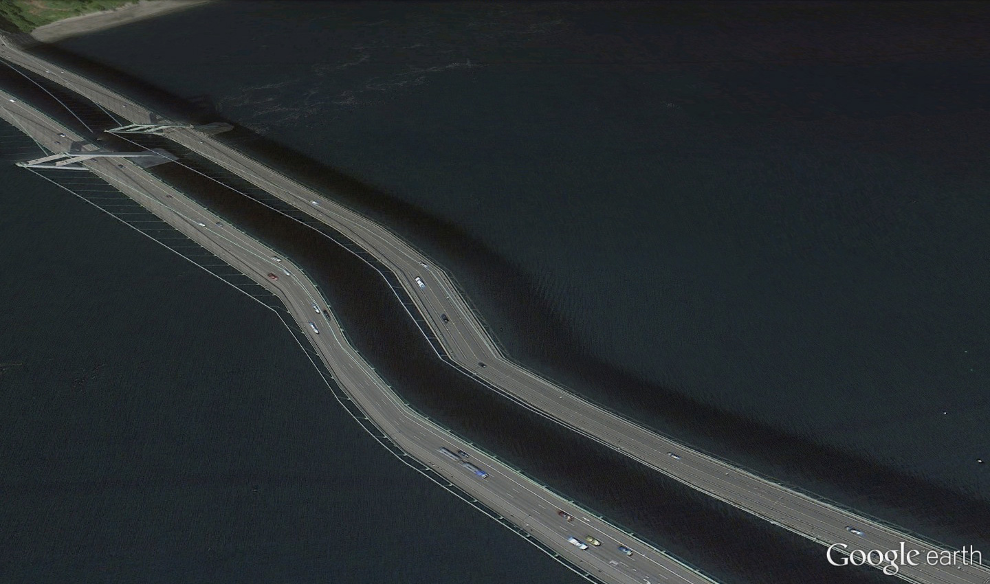
I collect Google Earth images. I discovered strange moments where the illusion of a seamless representation of the Earth’s surface seems to break down. At first, I thought they were glitches, or errors in the algorithm, but looking closer I realized the situation was actually more interesting — these images are not glitches. They are the absolute logical result of the system. They are an edge condition—an anomaly within the system, a nonstandard, an outlier, even, but not an error. These jarring moments expose how Google Earth works, focusing our attention on the software. They reveal a new model of representation: not through indexical photographs but through automated data collection from a myriad of different sources constantly updated and endlessly combined to create a seamless illusion; Google Earth is a database disguised as a photographic representation. These uncanny images focus our attention on that process itself, and the network of algorithms, computers, storage systems, automated cameras, maps, pilots, engineers, photographers, surveyors and map-makers that generate them.


 Clement Valla (USA, 1979). Lives and works in Brooklyn, New York. He received a BA in Architecture from Columbia University and a MFA from the Rhode Island School of Design in Digital+Media. He is currently an associate professor of Graphic Design at RISD. His work has been exhibited in several internationally places as The Indianapolis Museum of Art, Indianapolis; Museum of the Moving Image, New York; Thommassen Galleri, Gothenbur, etc. His work is available at clementvalla.com